Sunday, October 6, 2013

Mount Pisgah

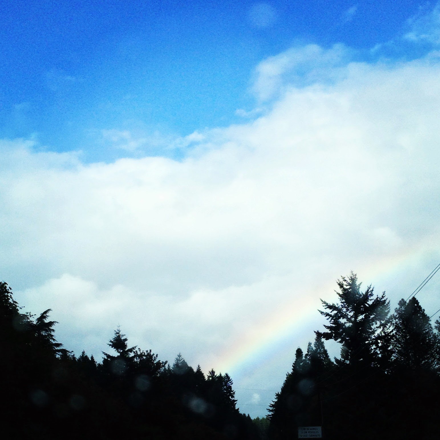
View from the trail.
WHENOctober 6, 2013


WHERE: Mount Pisgah, Eugene, OR.


WHY: We've explored the river that runs at the base of Mount Pisgah, attended fairs, and run in races at the base of the mountain, but had never summited.


WHO: Chris, Diana, Venice and Xander.

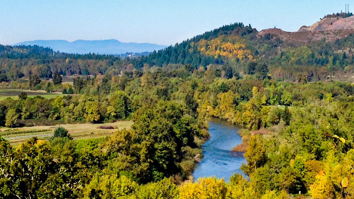
Panoramic view at the summit.


WEATHER: Super sunny and warm. 65-75 degrees F. Much of the path is open with no tree coverage.


WHAT:
Approximately 1.4 miles to the summit (<3 miles round trip), but there are a lot of different trails, so you could do more or less.
Summit is approximately 1,531 ft.


"I was woefully unprepared for the warm weather and length of hike. I wore jeans and my hair down. As a result, I was very unhappy. Venice loaned me her hairband, so I didn't completely melt. Next time, I'd like to bring a snack and blanket for the top.

Hot Hike
These heavy footsteps fall upon the path.
Hear the heaving breaths flying through thick air.
Unhappy huffings that puff their thickly wrath
While thudding through my hot, hot throat out there." - Diana

"It was longer than we thought. 1.8 miles uphill and we picked longer path down. There was a podium at the top with an elevation map on it." - Xander

"I liked the part of the hill with the gravel pile because it was fun to stand on, gave a good view, and I pretended to zipline on the power wires. On the way up, you feel like there is no shade. On the way down you feel like there is lots." - Venice


Sunday, September 22, 2013

Marys Peak


Somewhat protected by the tall trees.
WHEN: September 22, 2013


WHERE: Marys Peak, just southwest of Philomath, OR.


WHY: Today's hike was in lieu of camping due to poor weather conditions. Normally this hike has beautiful views of the Willamette Valley, Cascade Range and Pacific Ocean.


WHO: Chris, Diana, Venice and Xander.


The beautiful view from the summit.
WEATHER: Extremely windy with lots of rain. We guessed approximately 25 MPH winds with 40 MPH gusts? The wind made it cold.

"When I first went out, I though the weather was crazy. Some of the winds shook our car." - Xander

"I'm happy we made it to the top, it was a very short hike. If you don't want a long hike, don't go there, but if you want a nice place for lunch or a good place for pictures, do. I'm proud we made it because of the storm." - Venice


WHAT:
Approximately 1.5 miles.
Summit over 4,000 ft.
Round trip less than on hour.

Rainbow on the way home.
"I loved the energy and excitement of the kids on such a blustery day." - Chris

"It's a good place to play DnD because it's a forest with lots of natural habitats in it. I liked muddy log skipping!" - Venice

"I liked leaning back into the wind." - Xander

"Despite the crazy wind and rain, the kids had fun on the hike. They jumped puddles, climbed trees and discovered a really large worm. We were thankful for the warmth and dryness our car provided as well as the beautiful rainbow in store for us." - Diana


Monday, September 9, 2013

Lava River Caves

Looking back at the entrance.
WHEN: September 9, 2013

WHERE: Bend, OR. Near Sunriver.


WHY: This hike was to be able to say, "We summited at 8,000 ft above sea-level and then down a mile into the earth all in the same week."


Walking into the dark.
WHO: Chris, Diana, Venice and Xander.


WEATHER: Sunny and hot above ground, but dark and 40-42 degrees F in the caves. The late summer weather encouraged a lot of wasps buzzing around the entrance of the cave.


WHAT:
Approximately a 2 mile round trip.
Cave entrance is 4,500 ft above sea level. Deepest point in cave is 4,350 ft.


Glad to have a lot of light!
"It was so dark that it was pitch black. We brought flashlights and lanterns. I was scared of the dark and of bats. After awhile, I just felt brave. The walk was good." - Xander

"It was really amazing because at one point we were under the highway and at another point we saw sand castles. There were a bunch of little posts telling us where we were and how the lava tubes formed. I was a little scared too, but when Xander was scared, it gave me a reason to be brave, so that he could be brae too." - Venice

"I thought I'd be nervous walking deep into the earth, but the experience was so fascinating, I forgot to be afraid. I'm sure I would have screamed, but I was disappointed to not see any bats." - Diana

Saturday, September 7, 2013

Mount Bailey


WHEN: September 7, 2013

WHERE: Mount Bailey, Douglas County, OR.


WHY: Today's hike was to enjoy the company of family while on a beautiful hike. Summiting would be a bonus.


WHO: Uncle, cousins, Diana, Venice and Xander.


WEATHER: Sunny and warm. We saw temperatures in the mid 60s before our thermometer broke.


WHAT:
Approximately 6 miles.
Summit over 8,000 ft.
Round trip of 7.5 hours (including stops and lunch).


Scouting the way with Uncle Paul (top).
At the summit with the cousins (bottom).
"I liked the walking sticks because they made me feel safe, except at the climbing part. You definitely need hiking shoes. Teiya did not have good ones and she got blisters. At one point, you had to walk along a thin stretch of black rocks. It was about 5 feet wide, and the angle that the rocks fell wasn't too steep, so if you slipped, you wouldn't hurt yourself.

At the top, there was a golden marker that was bent over. If you're scared of heights, the cliffs look like they will kill you, but if you're not scared of heights, then you'll be fine. If you are afraid of heights, you can only go 3/4 of the way, but it's so beautiful, it's worth it. The mountain is kind of like a mind game with yourself." - Venice


"I saw rocks through the window and then we threw rocks through the window. The window is a giant hole in the mountain.

I was scared near the top. If you're afraid of heights, you can only go to the cone. Anything farther and it starts to get a little scary." - Xander

The Window
"I'm proud that all the kids did really well on the hike. Everyone carried their own water, food, and supplies. No one complained and it was an amazing day all around.

I got really scared (panicked, really) at one point and didn't quite make it to the top. At the time, it made sense and I was happy with what I accomplished, I was ok not summiting. As when I was descending, the place where I panicked didn't seem so bad, so I'm definitely interested in trying again someday. " - Diana


Monday, September 2, 2013

McDowell Creek Falls

The steps to the 
top of Majestic Falls
WHEN: September 2, 2013


WHERE: McDowell Creek Falls. 4 miles east of Lebanon, OR.


WHY: Today's hike was a trial run for next week's big hike up Mount Bailey. Several of us got new packs and shoes we wanted to break in.


WHO: Chris, Diana, Venice and Xander.


WEATHER: Sunny and warm.


WHAT:
Approximately 3 mile easy loop


Exploring the fallen logs above Royal Terrace Falls (on left).
Jumping streams below the Royal Terrace Falls (on right).
Lower and Upper views of Majestic Falls
"I liked going across all the bridges over the rivers and then climbing under them to get back where we started. The rocks were great to climb on because they were solid (they don't wiggle) and not too big or too small. Too small would mean I couldn't balance on them and too big wouldn't be fun.

It was definitely a scenic hike. This is the kind of place where magic would come from." - Venice


"The waterfalls were pretty. There were three waterfalls that were tall. The farthest waterfall, Majestic Falls, from where we parked was split in the middle." - Xander